

If you are trying to find a place on the Papua New Guinea provinces map, it helps to know that the country sorts its 22 provincial-level divisions into four regions: Southern, Highlands, Momase and New Guinea Islands. Once you know which region a province belongs to, you know roughly where to look: the south coast, the central mountains, the northern mainland coast, or the islands to the north and east.
This guide takes you through all 22 divisions region by region. Each entry gives the provincial capital and a short note on what the province is known for. It also explains why people say “22 provinces” when only 20 of them carry the name, and how a province breaks down into districts and wards.
Where the provinces sit on the map of PNG
Papua New Guinea occupies the eastern half of the island of New Guinea. Its land border with Indonesia’s Papua provinces runs roughly along the 141st meridian east. The country also includes many islands: New Britain, New Ireland, Manus, Bougainville, and island groups such as the Trobriands and the Louisiade Archipelago off the south-east tip.
A mountain range runs through the middle of the mainland, and that range explains most of the layout of the map. Provinces on the south side face the Coral Sea and the Gulf of Papua. Provinces on the north side face the Bismarck Sea. The Highlands provinces sit in the high valleys between, and the island provinces lie out in the sea to the north and east.
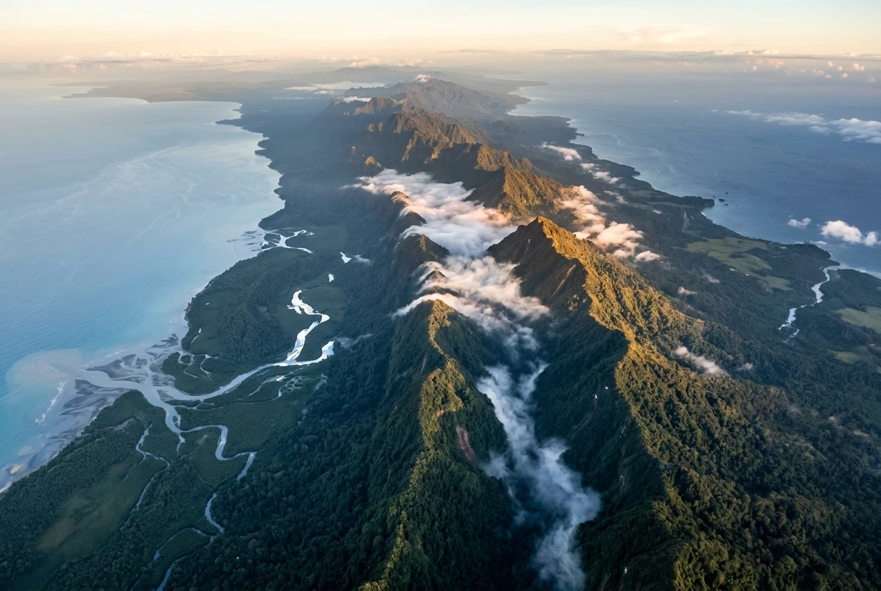
Image: Aerial view of the central cordillera of New Guinea at dawn: a spine of green, cloud-filled mountain ridges running away into the distance, with the pale blue Coral Sea coast and braided river mouths on one side and the darker Bismarck Sea on the other.
A quick way to read the map:
- South coast: Western, Gulf, Central, the National Capital District, Milne Bay and Oro.
- Central mountains: Enga, Western Highlands, Jiwaka, Simbu, Eastern Highlands, Southern Highlands and Hela.
- North coast of the mainland: Sandaun, East Sepik, Madang and Morobe.
- Islands: Manus, New Ireland, East New Britain, West New Britain and Bougainville.
Oro and Milne Bay are on the south-east side of the island, but Oro’s north-facing coast along the Solomon Sea means it is sometimes confused with the northern provinces. Its place in the Southern Region is explained below.
Why PNG says 22 provinces when only some are called provinces
The number 22 counts provincial-level divisions, which are the units that each have their own seat in the national Parliament. These are:
- 20 provinces. These carry the word “province” in their names or are commonly called provinces, for example Morobe Province and Enga Province.
- The National Capital District (NCD). This is the city of Port Moresby. It is not a province, but it is governed at the same level as one.
- The Autonomous Region of Bougainville. It is not called a province either, because it has its own government under the Bougainville Peace Agreement, signed in 2001.
Before 2012 the count was 20: 18 provinces, the NCD and Bougainville. Hela and Jiwaka were then formally created as provinces, which brought the total to 22. Older atlases, school textbooks and websites may still show the earlier figure. If you see “20 provinces” in a source that includes the capital and Bougainville, the source predates the two new provinces.
Names also change between sources. Northern Province is now usually called Oro. West Sepik is called Sandaun, from Tok Pisin for the place where the sun goes down. Chimbu is now commonly spelled Simbu. This guide uses the current common names and mentions the older ones where they matter.
The four regions and what each one covers
The four regions group provinces by geography and shared history. They are used in statistics, school geography, sport and a good deal of national administration. They do not have governments of their own, so there is no “regional parliament”. Real governing power sits with the national government, the provinces and the local-level governments underneath them.
Region Provinces and divisions Count Southern Central, Gulf, Milne Bay, Oro, Western, National Capital District 6 Highlands Eastern Highlands, Enga, Hela, Jiwaka, Simbu, Southern Highlands, Western Highlands 7 Momase East Sepik, Madang, Morobe, Sandaun 4 New Guinea Islands Autonomous Region of Bougainville, East New Britain, Manus, New Ireland, West New Britain 5
Six plus seven plus four plus five makes 22. Two names need explaining. “Momase” is built from the first letters of Morobe, Madang and Sepik. The Southern Region is often called the Papua region, since it covers the southern side of the island that was once administered as the Territory of Papua. Be careful with Southern Highlands: despite the name, it belongs to the Highlands Region, not the Southern Region.
Southern Region provinces: Papuan coast, Gulf and the capital
The Southern Region stretches along the south coast from the Indonesian border in the west to the islands off the south-eastern tip. It has the largest province by area, the national capital and some of the most remote river country in the Pacific.
- Western Province. Capital: Daru. The largest province by area, it takes in the Fly River basin and lowlands that stretch to the Indonesian border. The Ok Tedi mine operates here, and the article on what Ok Tedi mining means for Western Province and PNG covers it in detail.
- Gulf Province. Capital: Kerema. A low-lying coast of river deltas and swamp forest around the Gulf of Papua, with the Kikori and Purari river systems among its main waterways.
- Central Province. Provincial headquarters: Port Moresby. It surrounds the capital city and includes the southern end of the Kokoda Track. The city of Port Moresby itself is a separate division, which is why Central Province and the NCD are listed apart.
- National Capital District. Capital: Port Moresby. The seat of national government, Parliament and the country’s main international airport, on the Gulf of Papua coast. It is the smallest division by area and the most urban.
- Oro Province. Capital: Popondetta. Also known historically as Northern Province, it lies on the north-eastern side of the Papuan peninsula. Kokoda, at the northern end of the Kokoda Track, is in Oro, and the province is known for oil palm and farming on volcanic soils.
- Milne Bay Province. Capital: Alotau. A province of mainland tip and scattered islands, including the Trobriand Islands and the Louisiade Archipelago. It is known for sea travel, island cultures and the World War II Battle of Milne Bay in 1942.
On a map, find Port Moresby first. Central Province wraps around it, Gulf lies to the west along the coast, Western Province lies beyond that, and Oro and Milne Bay run east.
Highlands Region provinces, including the newer Hela and Jiwaka
The Highlands Region is the most densely settled part of the country and holds seven divisions. Its valleys sit at high elevation, with cool nights and good farming land, and the region is home to many of PNG’s best-known languages and customs. Mount Wilhelm, the country’s highest peak at about 4,500 metres, is in this region on the Simbu border.
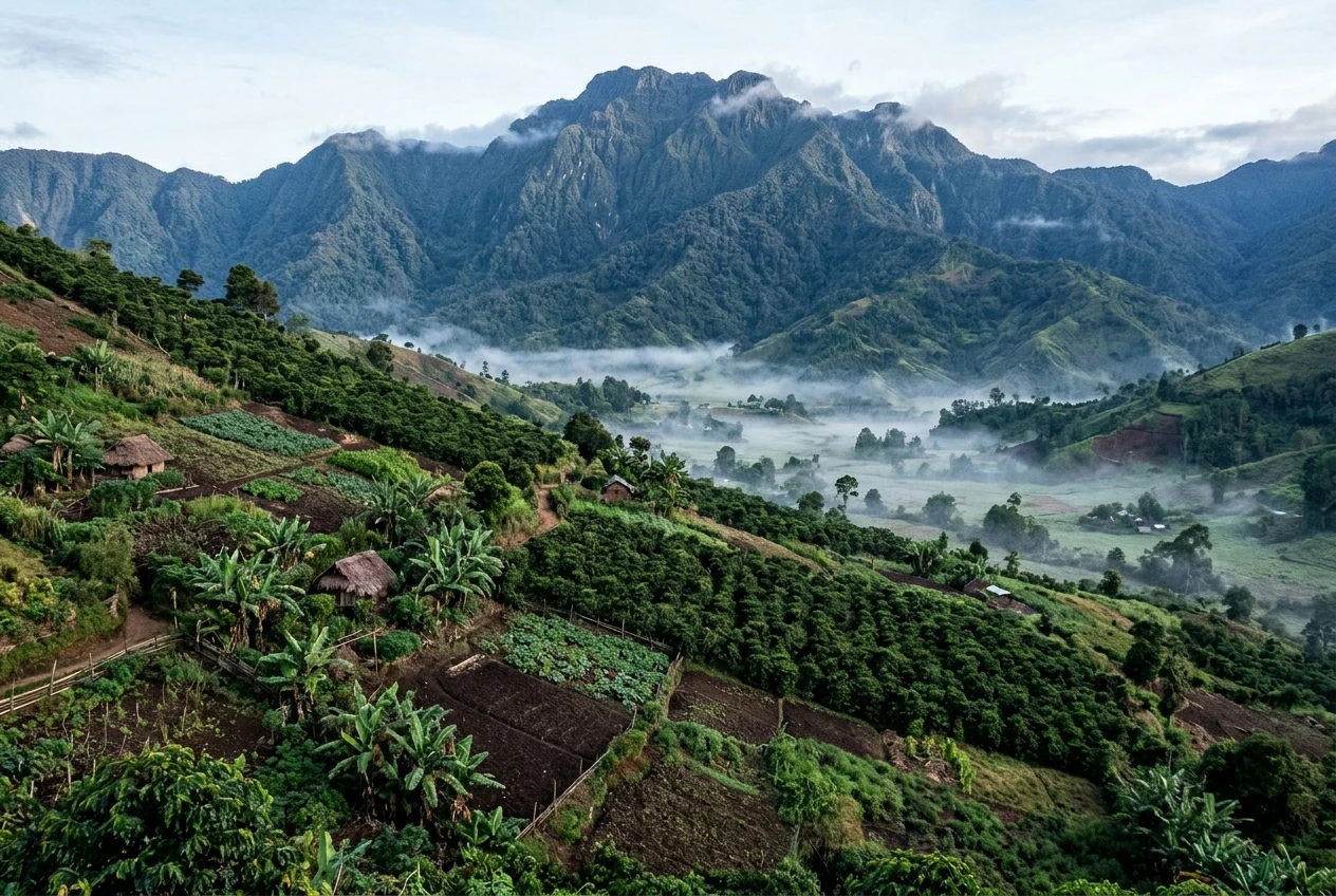
Image: A high Highlands valley at early morning: patchwork garden plots and coffee trees on terraced slopes, thin mist in the Wahgi Valley floor, and the forested bulk of Mount Wilhelm rising behind in soft cool light.
- Eastern Highlands Province. Capital: Goroka. A major coffee-growing province and home to the annual Goroka Show, which brings together groups from around the region.
- Simbu Province. Capital: Kundiawa. Steep, mountainous country that includes Mount Wilhelm, the highest point in the country.
- Western Highlands Province. Capital: Mount Hagen. Mount Hagen is the Highlands’ largest town and a commercial and transport hub, and it hosts the Mount Hagen Cultural Show, one of the best-known festivals in the country.
- Jiwaka Province. Capital: Minj. One of the two newest provinces, formally created in 2012 from part of the former Western Highlands. It sits in the fertile Wahgi Valley area and is farming country.
- Enga Province. Capital: Wabag. A high, rugged province in the western Highlands. The Porgera gold mine is in Enga.
- Southern Highlands Province. Capital: Mendi. A large Highlands province that was split in 2012, when its northern part became Hela.
- Hela Province. Capital: Tari. The other new province from 2012, carved out of the former Southern Highlands. The Tari area is associated with the Huli people, and the Hides gas field, which supplies the PNG LNG project, is in Hela.
If you are looking for the cultural side of the Highlands, the guide to cultural festivals that show PNG at its most spectacular is a good next read. On the map, the seven Highlands divisions form a rough east-west band across the middle of the mainland, with Enga at the west end and Eastern Highlands at the east.
Hela and Jiwaka are worth singling out because many printed maps and older school atlases do not show them. If your map draws Southern Highlands and Western Highlands as single large provinces, it is out of date.
Momase Region provinces from Morobe to Sandaun
Momase covers the northern coast of the mainland, from the Huon Gulf up to the Indonesian border. It has four divisions, and the name is a reminder that the region is defined by the Morobe, Madang and Sepik provinces, with Sandaun (West Sepik) joining the Sepik side.
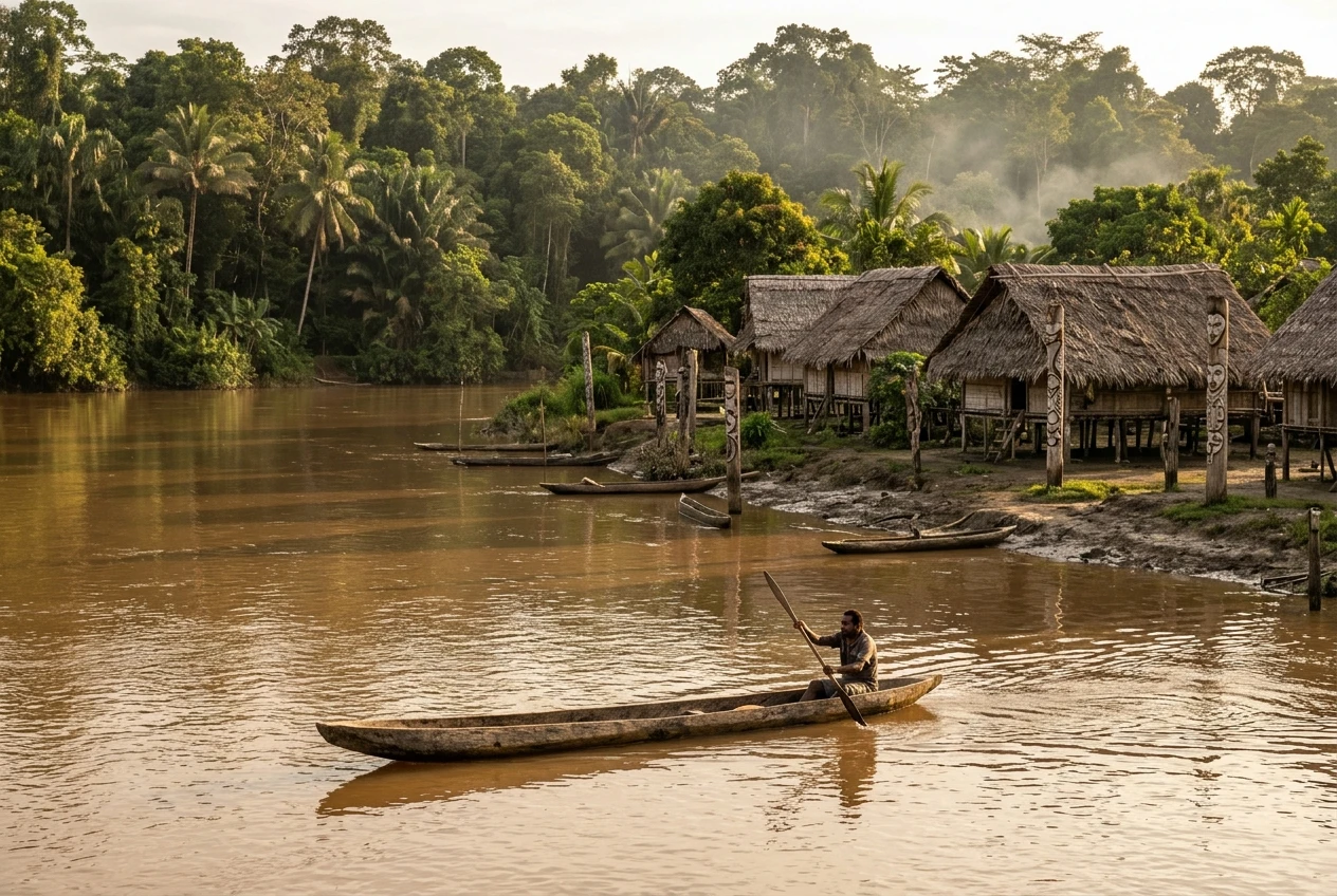
image: A long wooden dugout canoe with a paddler gliding on the broad brown Sepik River at golden hour, stilted thatched village houses and carved posts on the muddy bank, and dense green rainforest beyond.
- Morobe Province. Capital: Lae. Lae is PNG’s second-largest city and its busiest port, and it connects the Highlands to the sea by road. Morobe has the largest provincial population of any in the country.
- Madang Province. Capital: Madang. A coastal town known for its harbour and islands. The Ramu nickel mine is in Madang Province.
- East Sepik Province. Capital: Wewak. The Sepik River, one of the country’s great waterways, flows through here. The province is known for river villages and for carving and art traditions.
- Sandaun Province. Capital: Vanimo. Also called West Sepik. It is the north-west corner of the country, bordering Indonesia, and the capital Vanimo sits on the coast.
On a map, trace the north coast from east to west: Morobe, Madang, East Sepik, then Sandaun at the border. The Highlands provinces lie just inland from this strip, so Momase and the Highlands together make up most of the mainland north of the central ranges.
New Guinea Islands Region, from Manus to Bougainville
The New Guinea Islands Region is made up of the provinces that lie mainly or entirely on islands north and east of the mainland. It has five divisions, including the Autonomous Region of Bougainville.
- Manus Province. Capital: Lorengau. The Admiralty Islands, in the Bismarck Sea. Manus has the smallest population of the 20 provinces.
- New Ireland Province. Capital: Kavieng. A long, narrow island with a spine of hills. The Lihir Islands, home to the Lihir gold mine, belong to New Ireland Province.
- East New Britain Province. Capital: Kokopo. The Gazelle Peninsula, with the town of Rabaul, which was largely buried by volcanic eruptions in 1994. The provincial government moved to Kokopo after that.
- West New Britain Province. Capital: Kimbe. The western half of New Britain. Oil palm is a major crop around Kimbe.
- Autonomous Region of Bougainville. Capital: Buka. The island of Bougainville and nearby islands form a self-governing region with its own government. A non-binding independence referendum in 2019 produced an overwhelming vote for independence, and the region’s future political status continues to be discussed between Bougainville and the national government. For the latest position, check current news.
Geographically Bougainville is part of the Solomon Islands chain, even though politically it is part of PNG. On a map you will find it at the far north-eastern edge of the country.
For readers curious about mining, the article on how mining shapes PNG covers the Lihir, Porgera, Ok Tedi and Ramu operations and the rules around them.
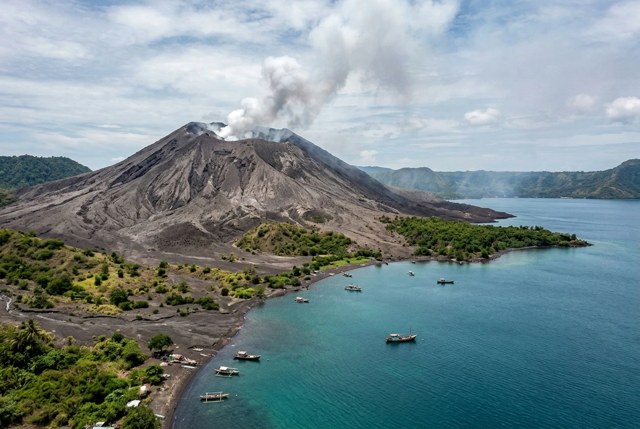
Image: The smoking cone of Tavurvur volcano above Rabaul’s Simpson Harbour, with ash-grey slopes meeting turquoise water, a few small boats at anchor and green regrowth along the shoreline under a tropical sky.
From province to district to ward: how PNG is governed locally
A province is the second level of government after the national level. Under it are districts, then local-level governments, then wards. The framework comes from the Organic Law on Provincial Governments and Local-level Governments, which took effect in 1995.
- National government. Based in Port Moresby, it sets national policy and makes national laws.
- Province. Each of the 20 provinces has a provincial government led by a governor. The governor holds the provincial seat in the national Parliament.
- District. Each province is divided into districts. Each district has an open electorate, which sends a member to Parliament.
- Local-level government (LLG). Districts are divided into LLGs, which can be urban or rural.
- Ward. The smallest unit. A ward is a group of villages or a part of a town, represented by a ward councillor.
The two special divisions work differently. The National Capital District is run by the National Capital District Commission, and its governor is elected like a provincial governor. Bougainville has its own constitution and an autonomous government, which handles many matters that provincial governments elsewhere do not.
Provincial borders and the number of districts have changed over time, so check an official source if you need exact figures for a school project or a report.
Questions readers ask about the PNG map and provinces
How many provinces does Papua New Guinea have?
There are 20 provinces, plus the National Capital District and the Autonomous Region of Bougainville, making 22 provincial-level divisions. Hela and Jiwaka were the last two provinces to be created, in 2012.
Which region is each province in?
The Southern Region has Central, Gulf, Milne Bay, Oro, Western and the NCD. The Highlands Region has Eastern Highlands, Enga, Hela, Jiwaka, Simbu, Southern Highlands and Western Highlands. Momase has East Sepik, Madang, Morobe and Sandaun. The New Guinea Islands Region has Bougainville, East New Britain, Manus, New Ireland and West New Britain.
What does Momase stand for?
Mo for Morobe, Ma for Madang and Se for Sepik. The name was formed from those three provinces and now applies to the whole northern-coast region, including Sandaun.
Is Port Moresby in a province?
Port Moresby is the National Capital District, a separate division. Central Province surrounds it, and the Central Province headquarters is also in Port Moresby.
Which is the largest province by area?
Western Province is the largest by area. The National Capital District is the smallest.
Which provinces are the newest?
Hela and Jiwaka, both formally created in 2012. Hela came from Southern Highlands and Jiwaka from Western Highlands.
What is the difference between Sandaun and West Sepik?
They are the same province. West Sepik is the older English name, and Sandaun is the Tok Pisin name now in common use.
Where can I plan a trip across several provinces?
The guides to essential travel tips before you visit Papua New Guinea and planning an adventure trip across PNG are good places to start. Distances between provinces can be long and many places are reached only by air or boat, so check current transport options before you travel.
Tell us about your home province
Every province on this map has more history and local detail than a short profile can hold. If you know your province well, send us a correction, a local place name or a verified community story through the Contact page. The provincial profiles on PAPUANIUGINI.ORG will keep growing with voices from outside Port Moresby, and the people who know these places best are the ones who can make them accurate.
