If you are looking for interesting facts about Papua New Guinea that you can check and use, this list has 50 of them, grouped by theme so you can go straight to the section you need. Each fact names its source, or says plainly where sources disagree. That makes the list suitable for school assignments, class presentations and anyone who wants to quote a figure with confidence.
The numbers on the list run from 1 to 50 so you can cite them easily. For the full story of how the country took shape, read our broader overview, What You Need To Know About Papua New Guinea.
Where Papua New Guinea Sits and How Big It Is
- Papua New Guinea occupies the eastern half of the island of New Guinea. The western half belongs to Indonesia and is divided into several Indonesian provinces. This matters because “New Guinea” can mean the island or the country, and mixing them up is a common mistake in assignments. (Source: CIA World Factbook)
- New Guinea is the second-largest island in the world, after Greenland. Australia is counted as a continent, so it is not ranked as an island. Sources agree on the order but round the area figures differently. (Source: Encyclopaedia Britannica)
- The country’s total area is about 462,840 square kilometres. The CIA World Factbook gives that total and lists the land area as somewhat smaller, at about 452,860 square kilometres. The gap is inland water. If a source gives a different number, check whether it counts lakes and rivers.
- Indonesia is the only country Papua New Guinea shares a land border with. For much of its length the border follows the 141st meridian east, a straight line that cuts across the island without following any river or ridge. (Source: CIA World Factbook)
- Port Moresby, the capital, is on the Gulf of Papua coast. Captain John Moresby, a British naval officer, named it in 1873 after his father, Admiral Sir Fairfax Moresby. The Motu-Koita people lived in the area long before that name existed. (Source: Encyclopaedia Britannica)
- The country is divided into 22 provincial-level units. There are 20 provinces, the National Capital District and the Autonomous Region of Bougainville. Hela and Jiwaka became provinces on 1 January 2012, so older maps show fewer. Our guide, Every Province on the Papua New Guinea Map, Sorted by Region, lists them with their regions. (Source: PNG National Statistical Office)
- Four regions group the provinces: Southern, Highlands, Momase and the New Guinea Islands. These regions appear in government planning, sport and everyday talk. Check which grouping your teacher wants, because some textbooks use only three or use different names.
- The country includes hundreds of islands. New Britain, New Ireland, Manus and Bougainville are the largest, and many smaller groups such as the Trobriands and the Louisiade Archipelago lie further off. Sources say “more than 600 islands”, but there is no single agreed count because definitions of an island vary.
Mountains, Rivers, Reefs and Wildlife
- Mount Wilhelm, on the border of Chimbu Province, is the highest peak in Papua New Guinea. Its height is usually given as 4,509 metres. Puncak Jaya, on the Indonesian side of the island, is taller at about 4,884 metres, so “highest in New Guinea” and “highest in Papua New Guinea” are different claims. (Source: Encyclopaedia Britannica)
- The Sepik and the Fly are the two great rivers. The Sepik flows to the north coast and the Fly to the Gulf of Papua. Lengths of roughly 1,100 kilometres for the Sepik and 1,050 for the Fly are widely quoted, but published figures differ by tens of kilometres depending on where each river is measured from. (Source: Encyclopaedia Britannica)
- Lake Kutubu in Southern Highlands is a Ramsar wetland of international importance. The Ramsar Convention lists wetlands that are recognised for conservation. The listing shows that PNG’s lakes and swamps matter far beyond the communities who live beside them. (Source: Ramsar Sites Information Service)
- Papua New Guinea is part of the Coral Triangle. This marine region also includes Indonesia, the Philippines, Malaysia, the Solomon Islands and Timor-Leste, and it holds more reef coral species than any other part of the ocean. Those six countries cooperate through the Coral Triangle Initiative. (Source: Coral Triangle Initiative on Coral Reefs, Fisheries and Food Security)
- Kimbe Bay in West New Britain is a well-studied reef area. The Nature Conservancy has worked with local communities there on marine protection, and it describes the bay as home to hundreds of coral species. It is a useful case study for assignments on conservation led by landowners.
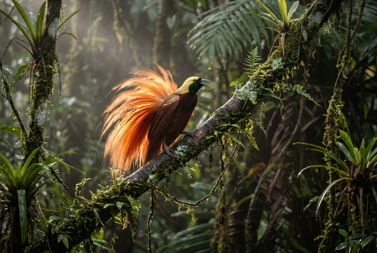
- Most birds of paradise live on New Guinea and nearby islands. The family contains somewhere between about 40 and 45 species. The total changes depending on which scientific classification is used, so name your source. (Source: Cornell Lab of Ornithology)
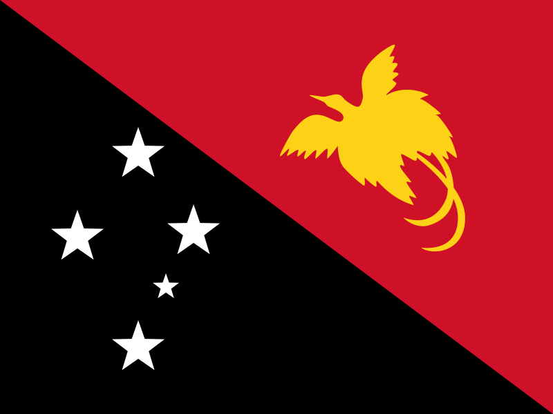
- The Raggiana bird of paradise is on the national flag and the national emblem. It is shown in gold on the red half of the flag. The bird links wildlife directly to national identity, which makes it a good starting point for a project on national symbols. (Source: PNG national symbols, Constitution and government publications)
- Matschie’s tree kangaroo lives only on the Huon Peninsula. The IUCN Red List classes it as Endangered, with habitat loss and hunting as the main threats. It is one of several tree kangaroo species found on the island. (Source: IUCN Red List)
- Queen Alexandra’s birdwing is the largest butterfly in the world. It is found only in the forests of Oro Province, and its wingspan can exceed 25 centimetres. It is listed in Appendix I of CITES, which bans international trade in wild specimens. (Source: CITES)
- New Guinea holds one of the largest tropical rainforests on Earth. Conservation groups often rank it third after the Amazon and the Congo basin, but rankings depend on how forest is measured and which year the data comes from. Treat the ranking as a general statement, not a precise one.
- The 1994 eruptions of Tavurvur and Vulcan destroyed much of Rabaul. The twin eruptions on 19 September 1994 forced the evacuation of the East New Britain town and buried it in ash. Papua New Guinea lies on the Pacific Ring of Fire, so volcanic and earthquake hazards are a real part of planning. (Source: Smithsonian Institution Global Volcanism Program)
- Some birds in Papua New Guinea are poisonous. Scientists reported in 1992 that the hooded pitohui carries batrachotoxin, a poison also found in certain frogs. The finding came from fieldwork in the country and surprised biologists worldwide. (Source: Science journal, 1992)
Hundreds of Languages and Many Peoples, Not One Culture
- More than 800 living languages are spoken in Papua New Guinea. Ethnologue, a widely used language database, gives the most cited count. Other linguists count differently because the line between a language and a dialect is a judgement, not a measurement. That is why you will see “about 840” in one book and “over 850” in another.
- Papua New Guinea has four official languages. They are Tok Pisin, English, Hiri Motu and PNG Sign Language, which Parliament recognised in 2015. Older sources list only the first three. (Source: PNG Department of Education)
- Tok Pisin is the most widely used common language. It grew from a pidgin form of English, with words from German and from local languages, and now serves as a first language for many younger people in towns. The word “wantok” comes from “one talk” and is explained in fact 49.
- Hiri Motu comes from the Motu language and the old Hiri trade voyages. The Motu people sailed large lakatoi canoes along the Gulf of Papua to trade pots for sago. The trade shaped a simplified form of Motu that later became a common language in the south. (Source: Encyclopaedia Britannica)
- The Constitution lists Five National Goals and Directive Principles. One is that development should take place through “Papua New Guinean forms of social and economic organization.” A teacher can use this to show that customary values are written into national law. (Source: Constitution of the Independent State of Papua New Guinea, via PacLII)
- Most land is held under customary ownership. The share is commonly given as about 97 percent, though sources round it differently and the figure is an estimate, not a survey result. It matters because mining, farming and tourism projects usually need agreement from landowning groups. (Source: PNG Department of Lands and Physical Planning; World Bank)
- The kina and the toea are named after traditional items. The kina was a pearl shell valued in exchange across the highlands, and the toea was a small shell used for smaller trade. The modern currency was introduced in 1975. (Source: Bank of Papua New Guinea)
- The Goroka Show and the Mount Hagen Show are two of the best-known cultural shows. Groups from many provinces gather to perform in traditional dress. Dates change from year to year, so confirm them with the organisers before planning anything. Our guide, Cultural Festivals That Show PNG at Its Most Spectacular, covers more events.
- The haus tambaran is a ceremonial house of the Sepik region. Entry to many of them is restricted by custom, and the carvings carry meanings that belong to the community. Treat any photograph or description as something shared with permission.
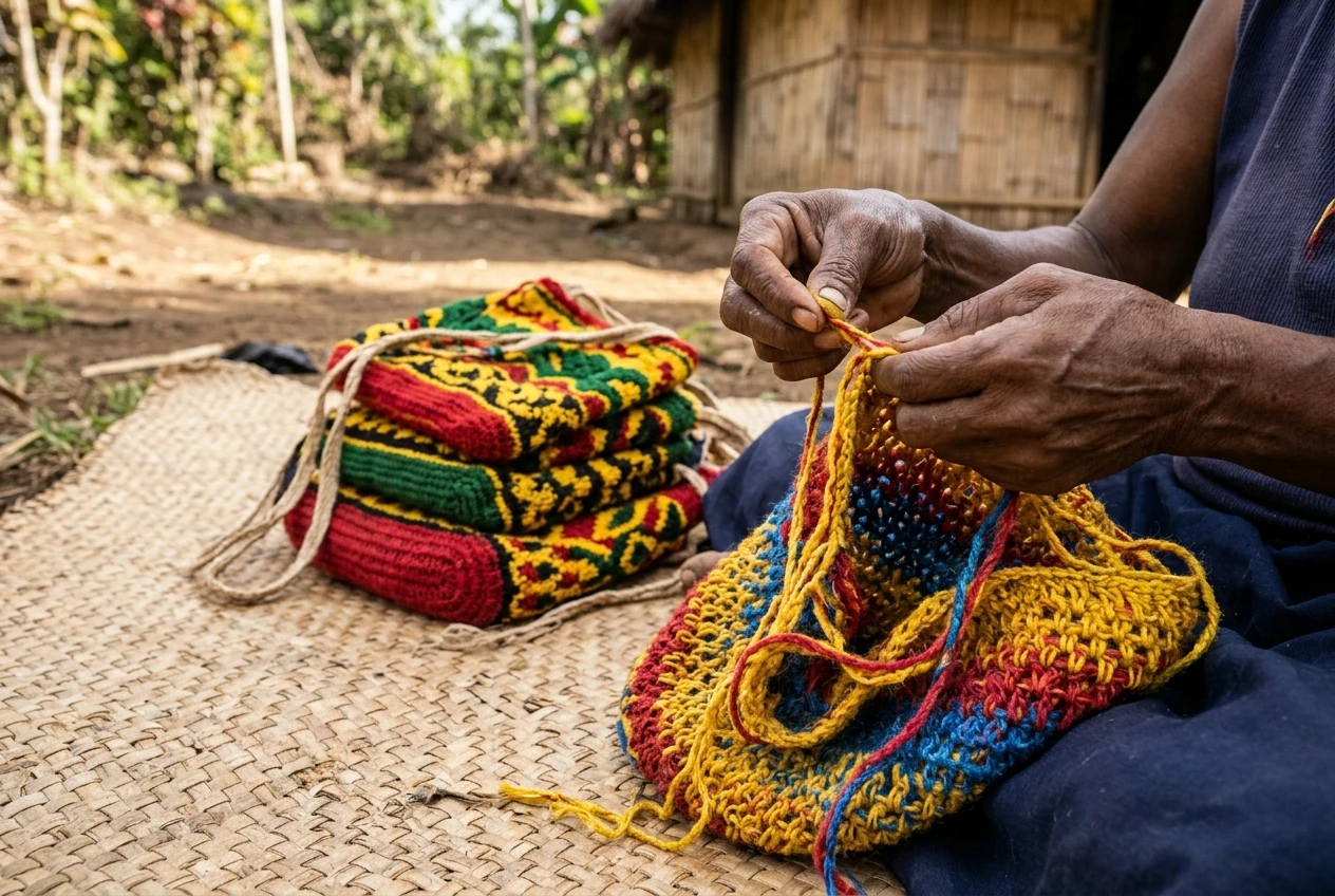
- The bilum is a hand-looped string bag made by women across many provinces. Materials, patterns and names differ from place to place, so avoid saying “the bilum” as if one tradition covered the whole country. Bilums carry vegetables, firewood and babies, and they are also sold as art.
From Early Settlement to Independence
- People have lived on New Guinea for at least 40,000 years. Many archaeologists cite about 50,000 years for first arrival, but dates are revised whenever new sites are tested. Anyone writing this fact should say “at least” and name the study they use. Our overview, What You Need To Know About Papua New Guinea, places this in the longer story. (Source: Australian National University archaeological research)
- Kuk Swamp in the Western Highlands is a UNESCO World Heritage site. It was inscribed in 2008 for evidence of early agriculture, which UNESCO says goes back at least 7,000 years. Some researchers argue the first drainage and planting is older still. (Source: UNESCO World Heritage Centre)
- The island was divided between colonial powers in 1884. Germany claimed the north and Britain the south, and the Dutch already held the west. Britain’s territory passed to Australia, and Australia took over the former German area after the First World War. (Source: Encyclopaedia Britannica)
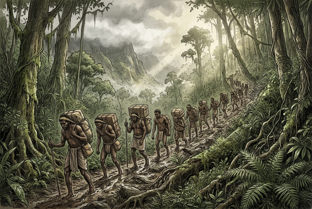
- The Kokoda Track campaign was fought in 1942. The track crosses the Owen Stanley Range and is usually given as about 96 kilometres long. Papuan carriers moved supplies and wounded soldiers along it, and their service is still remembered. (Source: Australian War Memorial)
- Self-government came on 1 December 1973, and independence on 16 September 1975. Michael Somare led the country as its first Prime Minister. Independence Day on 16 September is a public holiday. (Source: PNG Government)
- A student designed the national flag. Susan Karike, then 15, won the 1971 design competition with the red and black flag that carries the bird of paradise and the Southern Cross. It is a good example of ordinary citizens shaping national symbols. (Source: PNG national symbols, government publications)
- Bougainville voted overwhelmingly for independence in 2019. The Bougainville Referendum Commission reported about 97.7 percent in favour. The result was not binding on its own, and the political process for acting on it is led by the national and Bougainville governments. Check recent news before describing the current position.
- “Cargo cult” is a label scholars still debate. The term describes movements in Melanesia that were tied to hopes for new wealth and change after colonial contact. Many historians say the label hides how varied these movements were. Our article, Where the Cargo Cult Idea in Papua New Guinea Came From, explains the debate.
Mines, Farms and the National Economy
- Minerals and petroleum make up most of the country’s export earnings. Gold, copper and liquefied natural gas lead. PNG LNG, operated by ExxonMobil, shipped its first cargo in 2014. Check the Bank of Papua New Guinea for current export shares, since they change with prices. For the wider picture, read How Mining Shapes PNG: The Mines, the Money and the Rules.
- Ok Tedi began producing in 1984 in Western Province. It is a copper and gold mine at Mount Fubilan. BHP withdrew in 2002, and ownership has changed since, so it is important to separate the company’s old name from its present owners. Our article, What Ok Tedi Mining Means for Western Province and PNG, covers the history. (Source: Ok Tedi Mining Limited)
- The Lihir gold mine sits inside a volcanic crater on Niolam Island. The island is in New Ireland Province. Newmont acquired Newcrest, the previous operator, in 2023. Older articles may still name Newcrest as the owner. (Source: Newmont)
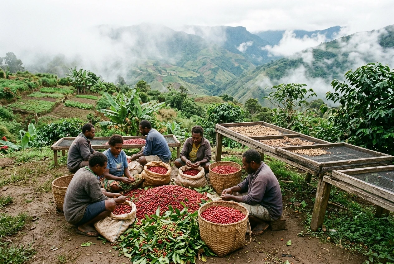
- Coffee, cocoa, copra and palm oil are major farm exports. Much of the coffee is grown by smallholder families in the highlands. Farm output is a main income for rural households, and it is affected by roads, shipping costs and world prices. (Source: Coffee Industry Corporation; PNG Cocoa Coconut Institute)
- The sweet potato, or kaukau, is a staple in the highlands. It was introduced from outside the region, but the date of arrival is debated, with archaeologists and historians disagreeing by centuries. In the lowlands, sago, taro and yam matter more. (Source: PNG National Agriculture Research Institute)
- Most people live in rural areas. The World Bank estimates the rural share at over 80 percent, and census-based figures are similar. This is why road projects, school access and health clinics affect national life far outside the towns. (Source: World Bank; PNG National Statistical Office)
- Pacific tuna fishing is a major source of income. PNG is a member of the Parties to the Nauru Agreement, which manages tuna access across the western Pacific. The size of licence income varies each year, so look up the current figure rather than quoting an old one. (Source: Parties to the Nauru Agreement Office)
Sport, Faith and Everyday Life
- Rugby league is the national sport. The national team, the Kumuls, plays internationally, and the PNG Hunters compete in Queensland’s state competition. An NRL team based in Papua New Guinea has been announced, and our article, The PNG Chiefs Identity, explains the logo. Check the NRL for the latest start date. (Source: National Rugby League)
- The Constitution refers to Christian principles. The preamble pledges to pass on “the Christian principles that are ours now.” Census returns have shown that over 90 percent of people identify as Christian, though denominations and local belief practices vary widely. (Source: PNG Constitution; PNG National Statistical Office)
- Churches provide many health and education services. Government documents have long described church agencies as running roughly half of rural health facilities, and they also operate many schools. The exact share changes over time, so ask the National Department of Health for current numbers. (Source: PNG National Department of Health)
- A wantok is a person who speaks your language. The Tok Pisin word means “one talk,” and it also describes the obligations that come with kinship, shared origin or friendship. The system provides support, and it also puts pressure on people who hold jobs or public office. (Source: Encyclopaedia Britannica)
- A mumu is a feast cooked in an earth oven. Food is wrapped in leaves and placed over hot stones, then covered with soil. Methods and foods differ between regions, and mumu often marks weddings, funerals and festivals.
Where the Numbers Disagree and Where to Check Them
Three kinds of figures cause most arguments in school work: population, language counts and area.
- Population. The 2011 census counted 7,275,324 people. More recent figures from the United Nations, the World Bank and the PNG government are estimates, and they differ because they use different methods and years. Always give the year next to the number, and check the National Statistical Office for the latest census release.
- Languages. Ethnologue’s count of more than 800 is widely used, but linguists draw the line between a language and a dialect in different places. For a school assignment, “more than 800” is safe.
- Area. The total of about 462,840 square kilometres includes inland water. The land-only figure is lower. State which one you mean.
For other checks, use these sources:
- National Statistical Office of Papua New Guinea, for census and survey data.
- PNG National Research Institute, for policy research on land, health and education.
- PacLII, for the text of the Constitution and national laws.
- Bank of Papua New Guinea, for currency, export and economic data.
- UNESCO World Heritage Centre, for Kuk Swamp and other listed sites.
- IUCN Red List, for the conservation status of animals.
- Ethnologue, for language counts, with its method noted.
Add a Fact From Your Province
This list was written from published sources, and published sources tend to focus on the capital and the big towns. If you know a fact, a place or a story from your own province that you can verify, send it in. Use our contact page to share it, along with where you found it, and it could be added so the list grows with voices from outside Port Moresby.